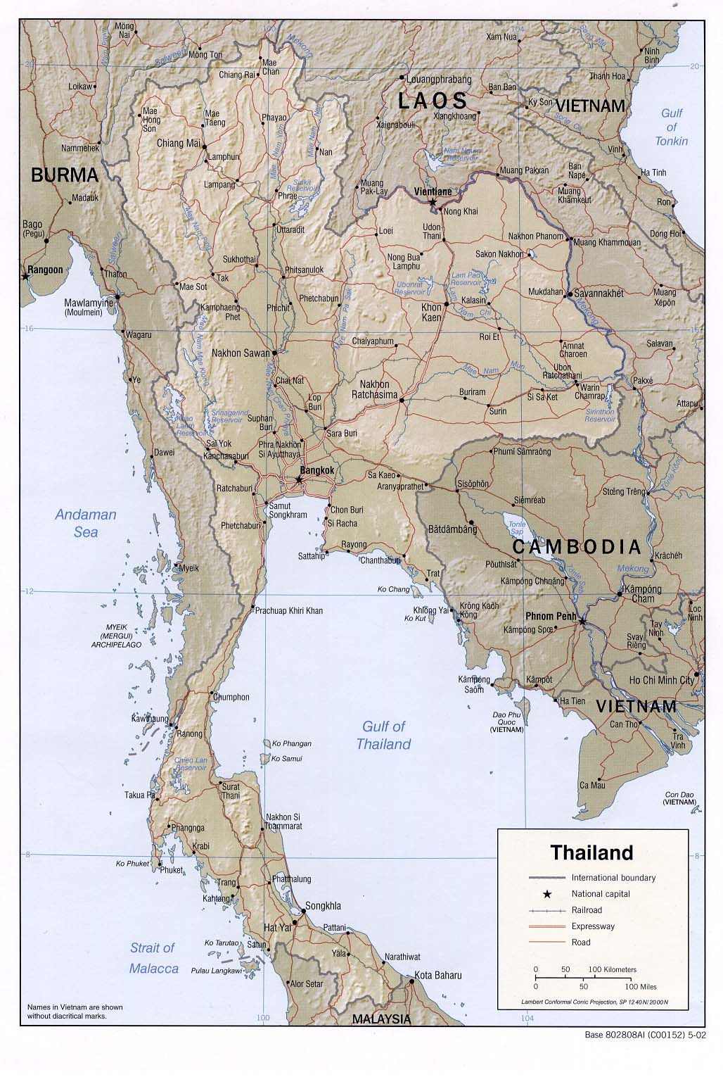
map of thailand

all of map of thailand,mapthai,thaimap,map province of thailand

Friday, August 18, 2006

tak province

Tak is a northern province covering an area of 6,406 largely mountainous square kilometres. The provincial capital is 426 kilometres north of Bangkok, and is situated on the Ping river basin. To the west, the border touches on Myanmar demarcated by mountain ranges and the Moei River.

bantakhouse.com/directions_map.html

chiangrai province

chiangmai province

CHIANG MAI Chiang Mai is Thailand's second largest city that plays an important role in economic, religion and politic of the North. It is located in a fertile valley of some 1,000 feet above sea level. It was also a principal ancient capital of Lanna Thai Kingdom. That's why Chiang Mai has very deep-rooted culture and tradition. ADMINISTRATION : CHIANG MAI IS ADMINISTRATIVELY DIVIDED INTO: AMPHOE MUEANG CHIANG MAI, AMPHOE CHAI PRAKAN, AMPHOE CHIANG DAO, AMPHOE CHOM THONG, AMPHOE DOI SAKET, AMPHOE DOI TAO, AMPHOE FANG, AMPHOE HANG DONG, AMPHOE HOT, AMPHOE MAE AI, AMPHOE MAE CHAEM, AMPHOE MAE RIM, AMPHOE MAE TAENG, AMPHOE MAE WANG, AMPHOE OMKOI, AMPHOE PHRAO, AMPHOE SAMOENG, AMPHOE SAN KAMPHAENG, AMPHOE SAN PA TONG, AMPHOE SAN SAI, AMPHOE SARAPHI, AMPHOE WIANG HAENG, KING AMPHOE DOI LO, KING AMPHOE MAE ON. BOUNDARY : NORTH = CHIANG TUNG OF MYANMAR SOUTH = LAMPHUN, TAK EAST = MAEHONGSON WEST = CHIANG RAI, LAMPANG, LAMPHUN AREA SIZE : 20,107 SQ.KM.


http://www.dtcp.go.th/workinfo/law_map/Chiang_Mai/pictures/Chiang_Mai_431.jpg


lampang province

ADMINISTRATION : LAMPANG IS ADMINISTRATIVELY DIVIDED INTO: AMPHOE MUEANG LAMPANG, AMPHOE CHAE HOM, AMPHOE HANG CHAT, AMPHOE KO KHA, AMPHOE MAE MO, AMPHOE MAE PHRIK, AMPHOE MAE THA, AMPHOE MUEANG PAN, AMPHOE NGAO, AMPHOE SOEM NGAM, AMPHOE SOP PRAP, AMPHOE THOEN, AMPHOE WANG NUEA BOUNDARY : NORTH = CHIANG RAI, PHAYAO SOUTH = SUKHOTHAI, TAK EAST = PHRAE WEST = CHIANG MAI, LAMPHUN
AREA SIZE : 12,543 SQ.KM.


Burmese ConnectionLampang has hosted human civilizations for over 1,400 years, yet the most influential period architecturally was the late 19th to early 20th centuries, when Burmese foremen worked in local teak mills. Burmese traders followed, and these two groups built fantastic temples throughout the city. Many still stand today (some with Burmese abbots) and are an important part of any visit to the north.

Phayao province

phare province

Thailand Map


Maps-Thailand.com has a number of travel maps, some with brief travel details. Our Hotel
Location Maps have sites of interest as well as hotel locations.

yahooligans.yahoo.com/.../Thailand/Maps/

nan province

bangkok map